

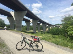
Montour Road 

Mile 0.0 ![]() 40.504833, -80.145083 • Elevation 728
40.504833, -80.145083 • Elevation 728
- 30 combined parking spaces, heavy use, gravel/dirt surface, water fountain, portable toilet, picnic shelter
- 15 spaces at MM 0.0 parking area
- 15 spaces at extended parking lot at MM 0.2
Hassam Road 
MM 1.4 ![]() 40.491733, -80.150967 • Elevation 762
40.491733, -80.150967 • Elevation 762
- 20 parking spaces, light use, gravel surfaces, water fountain, portable toilet
Beaver Grade
MM 3.1 ![]() 40.466750, -80.155350 • Elevation 816
40.466750, -80.155350 • Elevation 816
- 30 parking spaces, moderate use, gravel surfaces, water fountain, portable toilet
Park Manor
MM 4.4 ![]() 40.458950, -80.171596 • Elevation 844
40.458950, -80.171596 • Elevation 844
- 18 spaces at Park Manor Drive, water fountain, gazebo shelter, bike racks
Cliff Mine 

MM 5.9 ![]() 40.451816, -80.199784 • Elevation 878
40.451816, -80.199784 • Elevation 878
- 40 parking spaces, light use, rough asphalt surface, portable toilet, picnic shelter
Enlow
MM 7.6 ![]() 40.456117, -80.231167 • Elevation 946
40.456117, -80.231167 • Elevation 946
- 36 parking spaces, moderate use, dirt surface, water fountain, portable toilet
 Junction: Airport Connector
MM 7.8 ![]() 40.454667, -80.233667 • Elevation 942
40.454667, -80.233667 • Elevation 942
The Airport Connector is a combination trail/on-road link that runs about 6 relatively flat miles, from Enlow (MP 7.8) to the airport parking lot. It offers touring cyclists an alternate route from Pittsburgh International Airport to the Great Allegheny Passage trail network, since it avoids heavily trafficked Pittsburgh streets. You can find more information about the route near the end of this page, following the mainline trailheads listing.
Imperial
MM 8.2 ![]() 40.450254, -80.245710 • Elevation 978
40.450254, -80.245710 • Elevation 978
- 40 parking spaces (shared with activity center), moderate use, asphalt surface, drink vending machine
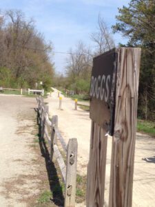
Boggs 
MM 11.4 ![]() 40.434567, -80.290117 • Elevation 1,153
40.434567, -80.290117 • Elevation 1,153
- 20 parking spaces, light use, dirt surface, portable toilet, primitive campsite
Harper Pavilion
MM 13.3 ![]() 40.411217, -80.289650 • Elevation 1,083
40.411217, -80.289650 • Elevation 1,083
- Shelter, water fountain
Quicksilver
MM 14.4 ![]() 40.394750, -80.284533 • Elevation 1,130
40.394750, -80.284533 • Elevation 1,130
- 16 parking spaces, light use, dirt surface, picnic shelter, portable toilet
Fort Cherry
MM 16.6 ![]() 40.373207, -80.254411 • Elevation 1,140
40.373207, -80.254411 • Elevation 1,140
- 30 parking spaces, limestone surface
J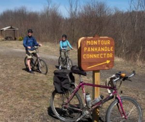 unction: Panhandle Trail Connector
MM16.9 ![]() 40.370047, -80.251923 • Elevation 1,005
40.370047, -80.251923 • Elevation 1,005
The Panhandle Trail stretches 29 miles between Carnegie, Pennsylvania, and Weirton, West Virginia. The original train corridor once connected Pittsburgh to Cincinnati, Chicago and St. Louis. Today the trail passes through rolling countryside and small towns where you can stop to explore or get a meal. One of the trail’s main features is the McDonald Train Station, which is close to the junction with the Montour Trail.
Montour–Panhandle Connector
MM 17.3 ![]() 40.363633, -80.249000 • Elevation 1,005
40.363633, -80.249000 • Elevation 1,005
- 18 parking spaces, gravel surface, light use, portable toilet
Galati Road
MM 21.2 ![]() 40.324400, -80.244400 • Elevation 1,058
40.324400, -80.244400 • Elevation 1,058
- 18 parking spaces, light use, dirt surface, water fountain, portable toilet, picnic shelter
Gilmore Junction: Westland Branch
MM 21.5 ![]() 40.321033, -80.239567 • Elevation 1,040
40.321033, -80.239567 • Elevation 1,040
The Westland Branch extends from Venice to Westland, a 4.1-mile stretch that offers rural beauty and solitude. This section runs parallel to an active railroad line. Westland’s access areas are detailed near the end of the page, following the mainline trailheads listing.
Venice
MM 22 ![]() 40.320317, -80.231409 • Elevation 1,037
40.320317, -80.231409 • Elevation 1,037
- ~3 parking spaces
Cecil Park 
MM 22.6 ![]() 40.317333, -80.219717 • Elevation 1,034
40.317333, -80.219717 • Elevation 1,034
- 50+ parking spaces, moderate use, asphalt surface, picnic shelter, water fountain, full restrooms in park
Ridgewood
MM 23.5 ![]() 40.316783, -80.206917 • Elevation 1,051
40.316783, -80.206917 • Elevation 1,051
- 10 parking spaces, light use
Muse Bishop
MM 24.1 ![]() 40.313305, -80.198933 • Elevation 1,090
40.313305, -80.198933 • Elevation 1,090
 Junction: Muse Branch
MM 24.3 ![]() 40.307566, -80.199743 • Elevation 1,100
40.307566, -80.199743 • Elevation 1,100
The Muse branch runs between a new community — McConnell Trails — and older neighborhoods in the Cecil-Muse area. Local residents enjoy a nice place to walk with their families, and visiting bicyclists and runners have a new destination to explore. The Muse branch showcases MTC’s first reforestation initiative, which includes honey locust, ginkgo, Kentucky coffee and tulip poplar from Tree Pennsylvania’s bare root tree project.
McConnell Road
MM 24.9 ![]() 40.315730, -80.187957 • Elevation 1,121
40.315730, -80.187957 • Elevation 1,121
- 14 parking spaces, light use, dirt surface, portable toilet
Kurnick
MM 25.6 ![]() 40.312875, -80.171391 • Elevation 1,058
40.312875, -80.171391 • Elevation 1,058
- 20 parking spaces, light use, dirt surface, drinking fountain, campsites, shelter, portable toilet
Hendersonville Park
MM 26.9 ![]() 40.301572, -80.157555 • Elevation 1,030
40.301572, -80.157555 • Elevation 1,030
- 20 parking spaces, light use, gravel/grass surface, shared with ball-field patrons, portable toilet, picnic shelter
Hendersonville 
MM 27.1 ![]() 40.299333, -80.150833 • Elevation 1,014
40.299333, -80.150833 • Elevation 1,014
- 53 parking spaces, heavy use, gravel surface, portable toilet
Linwood
MM 29.0 ![]() 40.300867, -80.122233 • Elevation 909
40.300867, -80.122233 • Elevation 909
- Light use, crushed limestone surface, portable toilet
Route 19
MM 30.4 ![]() 40.291967, -80.106700 • Elevation 921
40.291967, -80.106700 • Elevation 921
- 12 parking spaces + 1 handicapped space, heavy use, asphalt surface
Maplewood
MM 31.0 ![]() 40.285783, -80.099317 • Elevation 935
40.285783, -80.099317 • Elevation 935
- 22 parking spaces, 1 handicapped space on asphalt, another 6 parking spaces on dirt (across bridge), moderate use, portable toilet
E. McMurray
MM 32.1 ![]() 40.277867, -80.083633 • Elevation 1,004
40.277867, -80.083633 • Elevation 1,004
- ~ 18 combined parking spaces on both sides of intersection, moderate use, dirt surface, water fountain
Bebout
MM 32.7 ![]() 40.277183, -80.072617 • Elevation 1,020
40.277183, -80.072617 • Elevation 1,020
- 16 parking spaces, moderate use, asphalt surface, stairway to trail above
Bebout Handicap-Only Area
Mile 32.9 ![]() 40.279053, -80.069406 • Elevation 1,053
40.279053, -80.069406 • Elevation 1,053
- 3 handicapped parking spaces, light use, asphalt surface
Peterswood Park (Pavilion)
MM 32.9 ![]() 40.27794, -80.06610 • Elevation 1,138
40.27794, -80.06610 • Elevation 1,138
- ~ 50 parking spaces (shared with Peterswood Park Pavilion 4), paved asphalt surface, water fountain, picnic shelter, three sets of full bathrooms, within 0.25 mile south of the trailhead
Peterswood Park Sports Complex
MM 33.4 ![]() 40.281467, -80.062567 • Elevation 1,152
40.281467, -80.062567 • Elevation 1,152
- ~ 50 parking spaces (shared with Peterswood Park Softball Complex), paved asphalt surface, restrooms, picnic shelter, water fountain, within 0.25 mile south of the trailhead
Junction: Bethel Branch
MM 33.9 ![]() 40.287367, -80.056417 • Elevation 1,115
40.287367, -80.056417 • Elevation 1,115
Bethel Branch runs from Mile B-0.0 at Logan Road to Mile B-2.8 past Brush Run Road, through forested and residential neighborhoods, including the Montour Trail’s highest elevation. There are a number of amenities along the route. Bethel’s access areas are detailed near the end of the page, following the mainline trailheads listing.
Pittsburgh Regional Transit Library Station
MM 36.0 ![]() 40.287050, -80.019417 • Elevation 971
40.287050, -80.019417 • Elevation 971
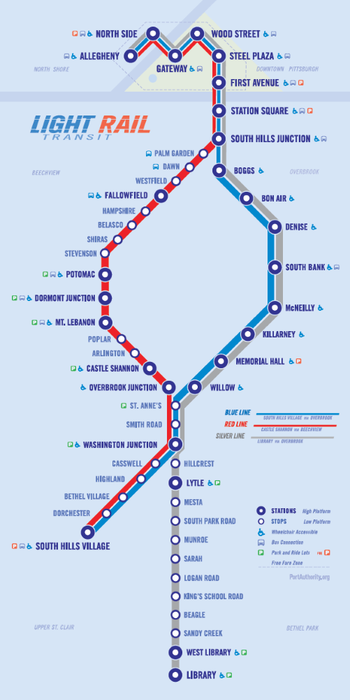
Click to enlarge.
![]() You can take the Pittsburgh light rail system (commonly called “T” for “transit”) from downtown (or any station in the South Hills) to the end of the silver line and get on the Montour Trail; the closest access is 0.7 mile east off Brownsville Road, a bit inconvenient for walkers but okay for cyclists. The Port Authority allows two bikes per light rail vehicle. While onboard, stow your bike in designated wheelchair spaces, and hold onto it securely while on the T; keep it clear of aisles, doorways, and other passengers. You must walk your bicycles at all times when accessing PRT T-stations.
You can take the Pittsburgh light rail system (commonly called “T” for “transit”) from downtown (or any station in the South Hills) to the end of the silver line and get on the Montour Trail; the closest access is 0.7 mile east off Brownsville Road, a bit inconvenient for walkers but okay for cyclists. The Port Authority allows two bikes per light rail vehicle. While onboard, stow your bike in designated wheelchair spaces, and hold onto it securely while on the T; keep it clear of aisles, doorways, and other passengers. You must walk your bicycles at all times when accessing PRT T-stations.
Stewart
MM 36.7 ![]() 40.289583, -80.008550 • Elevation 939
40.289583, -80.008550 • Elevation 939
- ~8 parking spaces, asphalt millings surface, portable toilet
Junction: South Park Connector
MM 36.8 ![]() 40.289350, -80.006267 • Elevation 955
40.289350, -80.006267 • Elevation 955
As its name implies, the South Park Connector links to the Montour Trail, connecting these two great outdoor resources. The 2.4-mile crushed asphalt trail is in a natural wooded setting that features a steel bridge over pristine Sleepy Hollow Run. Hilly park roads complete the route to Corrigan Drive.
Brownsville Road Ext.
MM 37.5 ![]() 40.287083, -79.996650 • Elevation 920
40.287083, -79.996650 • Elevation 920
- ~10 spaces, asphalt millings surface
Piney Fork (West)
MM 37.7 ![]() 40.287167, -79.991050 • Elevation 910
40.287167, -79.991050 • Elevation 910
- ~10 spaces, asphalt paved surface, portable toilet
Triphammer Road (West)
MM 38.2 ![]() 40.282167, -79.986400 • Elevation 937
40.282167, -79.986400 • Elevation 937
- ~6 spaces west parking area; east parking area ~6 spaces, asphalt paved
Piney Fork (East)
MM 39.5 ![]() 40.274339, -79.970651 • Elevation 842
40.274339, -79.970651 • Elevation 842
- portable toilet
Gill Hall CLOSED; campground is open
MM 40.6 ![]() 40.279833, -79.955367 • Elevation 810
40.279833, -79.955367 • Elevation 810
- portable toilet, campsite; Note: The campsite is not for car camping, and persons using it in that manner will be charged with trespassing.
Route 51 (Park & Ride lot)
MM 44.2 ![]() 40.292900, -79.911250 • Elevation 770
40.292900, -79.911250 • Elevation 770
- 400 spaces, asphalt-paved surface; lot never full
Clairton
MM 46.6 ![]() 40.305891, -79.885481 • Elevation 754
40.305891, -79.885481 • Elevation 754
- ~25 spaces, asphalt-paved surface, portable toilet, water fountain
CONNECTOR: AIRPORT
MM 7.8/ Mile A-0.0 ![]() 40.454667, -80.233667 • Elevation 942
40.454667, -80.233667 • Elevation 942
MM A-6.3 ![]() 40.496233, -80.261917 • Elevation 1,132
40.496233, -80.261917 • Elevation 1,132
The Airport Connector is a combination trail/on-road link that runs about 6 relatively flat miles, from Enlow (MP 7.8) to the airport parking lot, making Pittsburgh more accessible to bicycle tourists. The connector is well-signed and travels through residential neighborhoods along Enlow Road, Clinton-Enlow Road, McCaslin Road, Clinton Road, airport service roads, and a designated trail. Caution: For much of the route, you share the roadway with car/truck traffic. There are few (if any) amenities along the route. The trailhead terminus abuts the landside terminal’s moving walkway in the extended-term parking lot. Inside the airport, baggage claim hosts an area where bicyclists can disassemble/reassemble their bikes pre-/post-flight.
The closest access areas are McLaren Road (Enlow), which is 0.2 mile to the east of the junction; Findlay Township Activity Center (Imperial), 0.6 mile to the west; and the Pittsburgh International Airport at the northern terminus.
WESTLAND BRANCH
MM 21.6/W-0.0 (no markers) ![]() 40.321033, -80.239567
40.321033, -80.239567
MM W-4.1 (no markers) ![]() 40.279567, -80.270367
40.279567, -80.270367
The Westland Branch connects to the Montour Trail mainline at Gilmore Junction and runs 4.1 miles through predominantly rural farmlands to Venice. Because an active rail line parallels the Trail, it is not overgrown — offering great views of the surrounding countryside: hawks gliding overhead, cattle grazing in rolling pastures, wild flowers and interesting bushes blowing at the trail’s edge. If train watching is your thing, you might be able to see (up close) one of the MarkWest tank trains, which creep quietly by at a few miles per hour.
Westland Trailhead, Hornhead Road
MM W-4.1 (no markers) ![]() 40.279567, -80.270367 • Elevation 1,076
40.279567, -80.270367 • Elevation 1,076
- ~212 parking spaces, light use, portable toilet
BETHEL BRANCH
MM B-0.0 ![]() 40.287367, -80.056417
40.287367, -80.056417
MM 33.8/B-2.8 ![]() 40.317639, -80.047500
40.317639, -80.047500
Bethel Park Branch runs from MM B-0 just past Brush Run Road to MM B-2.8 at Logan Road, through heavily forested and residential neighborhoods. The trees, wildflowers and vegetation that line both sides of the Trail are home to a variety of animals, including deer that frequently jump onto the path. There are a number of amenities (portable toilets, water fountains, and benches) along the route. It is a high-usage section, so we recommend courtesy as you share the Trail.
Brush Run Road
MM B-.05 ![]() 40.317639, -80.047500 • Elevation 1,172
40.317639, -80.047500 • Elevation 1,172
- ~ 60 total parking spaces on both sides of Brush Run road, 1 handicapped parking space, light use, combination asphalt/dirt surfaces, portable toilet
Limestone Drive
MM B-1.5 ![]() 40.304950, -80.067667 • Elevation 1,200
40.304950, -80.067667 • Elevation 1,200
- 9 parking spaces, heavy use, crushed limestone surface, water fountain
Bethel Road
MM B-1.9 ![]() 40.310117, -80.067833 • Elevation 1,211
40.310117, -80.067833 • Elevation 1,211
- No parking spaces, portable toilet only
Clifton Road
MM B-2.1 ![]() 40.312031, -80.064037 • Elevation 1,216
40.312031, -80.064037 • Elevation 1,216
- 11 parking spaces (available only during non-school hours), moderate use, asphalt surface, year-round portable toilet
Irishtown Road
MM B-2.8 ![]() 40.315750, -80.049083 • Elevation 1,181
40.315750, -80.049083 • Elevation 1,181
- 23 parking spaces, heavy use, crushed limestone surface, portable toilet